Showing posts with label GPS. Show all posts

Saturday, September 6, 2008

Myguide GPS camera m.icatcher


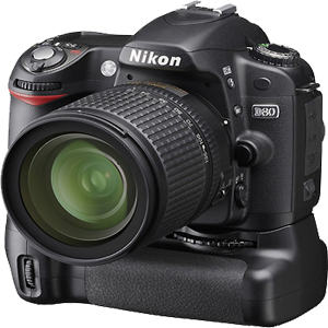
Called m.icatcher this is the point-and-shoot camera with embedded GPS from MyGuide. It targets the ever growing market of photo tagging. Each time you snap a photo this camera instantly adds the location where the picture was taken to the JPG file.

Unlike existing GPS solutions the camera does not suffer from cold starts. The GPS signal is simply captured at the instant the shutter is triggered. And when you transfer your pics to the PC the power consuming processing part is done on your PC therefore the GPS feature only has a low power demand. So you don’t have to worry about GPS chip draining your battery or having to wait minutes before you can take a picture.

All we know is that MyGuide m.iCatcher was on display at IFA 2008 last week and will be available in Europe pretty soon.

Read rest of entry

GPSMap 5012


Continuing over coverage of marine navigation systems we also want to talk about Garmin GPSMap 5012. This is one of the high end marine navigators from Garmin with a suggested retail price of $3885. However Amazon have a few of them in stock for $2970.

The GPSMAP 5012 is touch screen based interface with satellite enhanced worldwide base map. The wide 12.1” screen helps for easy navigation by pointing finger on the screen. GPSMAP 5012 comes with preloaded Maps of all over world along with high-resolution satellite images. The product is adaptable to new additions and details in to the Maps with integrated SD memory card reader. The 3D show is user friendly and has a auto guidance technology which avoids road blocks or depth waters. It is connected to Garmin Marine Network.

Features of Garming GPSMap 5012:

Graphics and Video
It has worldwide base map with high quality satellite images compared to more traditional maps in other products available in the market. We can add maps easily with card slot without connecting to a computer. It has high quality video resolution and big XGA screen graphics. It has video connectivity option with live in the boat.

BlueChart g2 Vision
The optional BlueChart g2 vision card feature is useful for the graph plotter.

Read rest of entry

Navigon 2200T


NAVIGON is proving to be one of the fastest growing suppliers of gps navigation products around the world. They provide Real Time Traffic Updates for life; standard on a wide range of its new products. We had already mentioned the Navigon 2200 and 2210 but not the Navigon 2200T which was announced a couple of days ago. Navigon 2200T GPS navigator is new version of Navigon 2200 series and it looks like this will be the version to be available in the States.

It has a 3.5 inch touch screen and offers free real-time traffic updates for the life of the product. NAVIGON’s real-time traffic updates product software makes route calculation fast and entering a destination easy, requiring fewer clicks than any other GPS product to enter a destination. Navigon 2200T comes preloaded with Navteq maps of the lower 48 states. The device provides 3D renderings of highway interchanges and it should be available for $229.

NAVIGON 2200T features include:

  • Reality View Pro
  • Lane Assistant Pross
  • Fast Destination Entry
  • Advanced Text-to-speech
  • Direct Help
  • High Performance
  • Instant Fix GPS
  • Ultra-thin and portable
  • Multidestination trip planning
  • DirectHelp for locating the nearest roadside assistance and other emergency services
Read rest of entry
 

Followers

Recommended Gadget

  • ads
  • ads
  • ads
  • ads

Gadget News, Reviews and Discussion Copyright © 2009 Gadget Blog is Designed by Ipietoon Sponsored by Online Business Journal